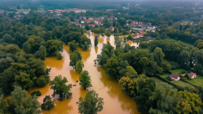
Floods are among the most devastating natural disasters, causing significant loss of life and property. Climate change is expected to increase the frequency and intensity of flooding events, making technology crucial for effective monitoring and management. Scientists highlight the importance of advanced technology in flood monitoring: “With the changing climate and growing population, it’s critical to be able to quantify our water resources.”
Space imagery remains the leading solution to this problem and provides near real-time data essential for assessing deluge impacts. Advanced satellite systems offer high-resolution Earth images for rapid analysis and response planning. The EOSDA LandViewer platform enhances this capability by providing detailed geospatial analysis, time-series evaluations, and the ability to download high-resolution satellite imagery.
Future integration of AI and machine learning with satellite data will further improve inundation risk prognosis and management. Let’s take a closer look at how these technologies work together to predict flooding and help save lives.
Satellite Technology: A Game Changer for Flood Monitoring
Floods, often termed “nature’s fury,” wreak havoc across the globe, but thanks to remote sensing technology, we can now monitor these disasters from space. Space imagery plays a pivotal role in deluge management by providing timely and accurate data crucial for decision-makers. With the ability to cover vast areas quickly, satellites offer a bird’s-eye view of flooding events, allowing for efficient assessment and response.
One of the primary functions of satellite data is flood mapping. High-resolution optical and radar imagery can delineate flooded areas with remarkable precision. For instance, very-high-resolution satellites can achieve resolutions as fine as 15 cm, enabling detailed assessments of infrastructure damage and affected landscapes. This capability is invaluable for emergency responders who need to swiftly determine the extent of flooding.
Moreover, space imagery enhances predictive modeling. Researchers can identify vulnerable regions and forecast potential inundation risks by analyzing historical data alongside near real-time observations. Advanced artificial intelligence algorithms process vast amounts of satellite data to generate rapid flood forecasts and alerts, transforming raw data into actionable insights.
The integration of various satellite technologies further amplifies their effectiveness. For example, while optical imagery provides clear visuals during fair weather, radar technology shines during storms when clouds obscure traditional views. This dual capability ensures continuous monitoring regardless of atmospheric conditions.
Hendrik Bernert from EOMAP noted that “Satellite remote sensing is an efficient and cost-effective tool to assess physical and biological parameters in aquatic ecosystems.” This means that even before the waters rise, we can anticipate their impact on communities and ecosystems.
In summary, satellite data is not just a luxury but a necessity in modern flood management. By providing comprehensive insights into flooding dynamics, it empowers stakeholders to make informed decisions that could save lives and mitigate damage. The future of inundation monitoring is indeed hopeful — thanks to our watchful eyes in the sky. Let’s explore a leading high-res satellite imagery platform and learn how it assists scientists in predicting deluge events.
Enhancing Flood Monitoring with EOSDA LandViewer
EOSDA LandViewer emerges as a powerful ally in flood monitoring, transforming satellite data into actionable insights. This innovative platform offers tools designed to analyze and visualize changes in land and water resources, making it indispensable for deluge detection and management. It enables users to monitor flooded areas in near real-time, which is essential for timely decision-making.
The platform allows users to perform advanced time series analysis and apply custom spectral indices, which can reveal patterns and trends associated with flooding. Moreover, the platform’s user-friendly interface simplifies complex data processing tasks. Users can easily search for specific areas of interest (AOI), apply advanced filters, and download high-quality satellite images. This feature streamlines the workflow for emergency responders and environmental managers alike.
A striking example of the platform’s capabilities is demonstrated in Kazakhstan, where EOSDA LandViewer was applied to predict and assess inundation impacts.
In Northern Kazakhstan, spring floods pose significant challenges due to rapid snowmelt and heavy precipitation. The EOS Data Analytics team has developed a flood detection method that utilizes machine learning models trained on historical flood and weather data, achieving over 90% prediction accuracy. This model forecasts potential inundation areas by analyzing meteorological factors such as temperature and snow depth.
In March 2023, severe flooding led to a natural emergency declaration, highlighting the importance of proactive measures like dam reinforcement and canal maintenance. Despite these efforts, infrastructure issues persist, with many hydraulic structures in need of repair.
The model was tested in the Atbasar district, where past deluges have caused extensive damage to homes and agriculture. By employing a linear multiple regression analysis, the EOSDA team effectively predicted flood occurrences, demonstrating the model’s viability for future applications in flood management and agricultural planning. This approach not only aids in immediate response but also offers long-term strategies for mitigating inundation impacts.
In summary, EOSDA LandViewer is at the forefront of flood monitoring technology, providing essential tools to enhance our understanding of deluge events. As climate change continues to pose challenges, this platform will be vital in safeguarding communities and ecosystems from flood impacts. What other technologies aid in forecasting flooding disasters, and what is their future potential? Let’s find out.
The Future of Satellite Imagery in Flood Monitoring
The future of inundation monitoring is set to be transformed by advancements in space imagery and emerging technologies. Enhanced imaging capabilities, such as synthetic aperture radar (SAR) and high-resolution optical sensors, are paving the way for unprecedented accuracy in flood mapping. SAR can penetrate cloud cover, making it invaluable during storms. To put it metaphorically, “When the skies are gray, SAR is our ray of hope.”
Integrating machine learning and artificial intelligence will revolutionize data interpretation, allowing for precise deluge risk predictions. For example, North Carolina State University researchers use high-resolution multispectral satellite imagery and machine learning to improve urban inundation mapping.
Internet of Things (IoT) devices also provide real-time data on water levels and rainfall. When combined with satellite imagery, IoT devices create a comprehensive monitoring system that allows for dynamic adjustments in disaster management.
Integrated with space imagery, Geographic Information Systems (GIS) will remain essential for visualizing and analyzing flood data, enabling detailed risk assessments and effective evacuation plans.
In summary, the future of satellite imagery for flood monitoring looks promising and diverse. With technological advancements and the integrating of various systems, we are poised to enhance our understanding and management of floods like never before.


